Haz clic aquÍ para leer en español
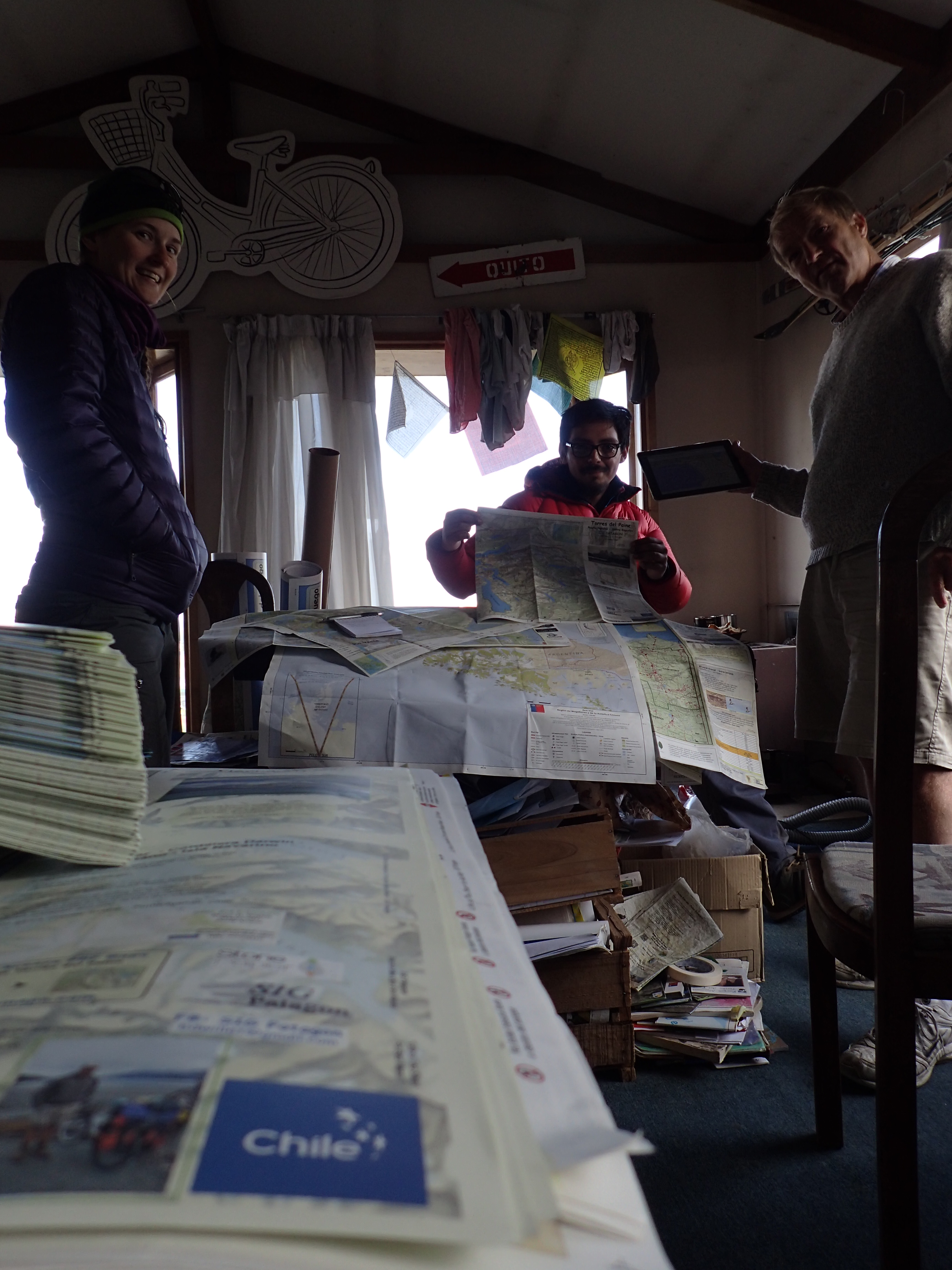
From Punta Arenas, we traveled along abandoned 4-wheel tracks and some easy cross country. Navigating out of the city, we traveled westbound. We sat in the city dump on the outskirts and reflected on the life choices which had brought us to this point, deeming them generally awesome and continued west using a combination of Google Earth images, beta from Bruce, creator of SIG Patagon and relying heavily on his maps.
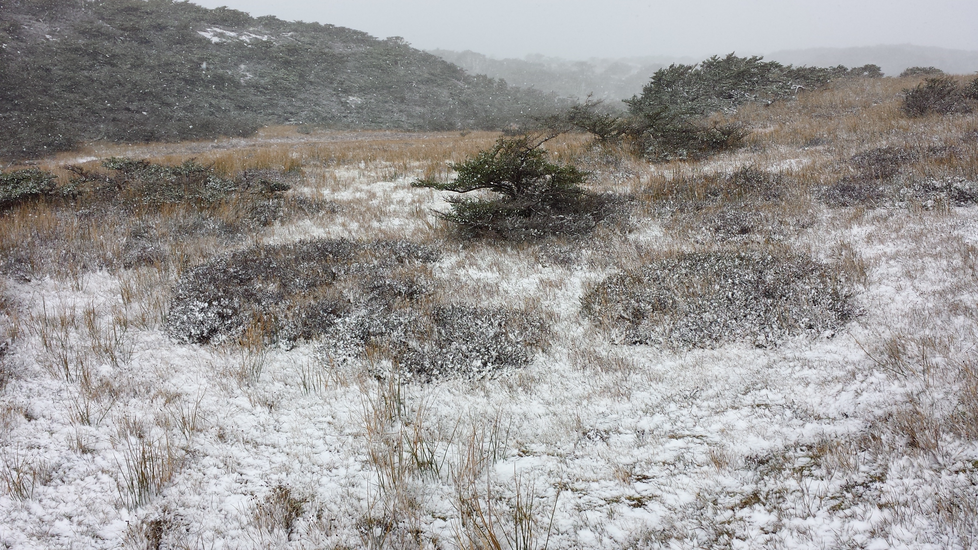 Chubascos of snow began to catch us. We found ourselves some kilometers off our intended route but continued west hopefully. As the bad weather had begun to deteriorate the resolution of the Google images, we sought some sort of route through the thick forest which separated us from the west. We found ourselves out on the open tops of the open cerros as the worst of the chubascos rolled in. We backtracked, making for about a half day of “learning experience.” We found the route we had sought and tried to make up time by hiking in to the evening as the sun stays up until about 10 pm here.
We emerged onto a high flat space, clear cut some many years ago. Here another chubasco caught us just as the Platypus bladder in my backpack sprung a leak and dumped water all down my back. We found a merciful grove of trees, set up the tent and spent a cold, wet night listening to slush and rain fall and freeze to our tent.
The next morning there was snow on the ground as we again began westbound on abandoned farm roads. The general rules of the trail are the same down here, leave a gate as you found it and don’t have a fire if there is danger of it spreading. With the constant, ripping wind, open fires were out of the question in the open space through which we were passing.
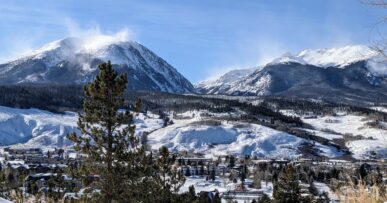
The chubascos continued. I felt like I was back in Colorado, climbing out of a treed gully and seeing a snow flurry against blue skies above us. We eventually emerged to the estancia of Marcos and Dianna.
From there, we line-of-sight navigated toward the coast, to Seno Otway. In two days, we had hiked from the Atlantic to the Pacific. That afternoon we walked into a penguin colony.
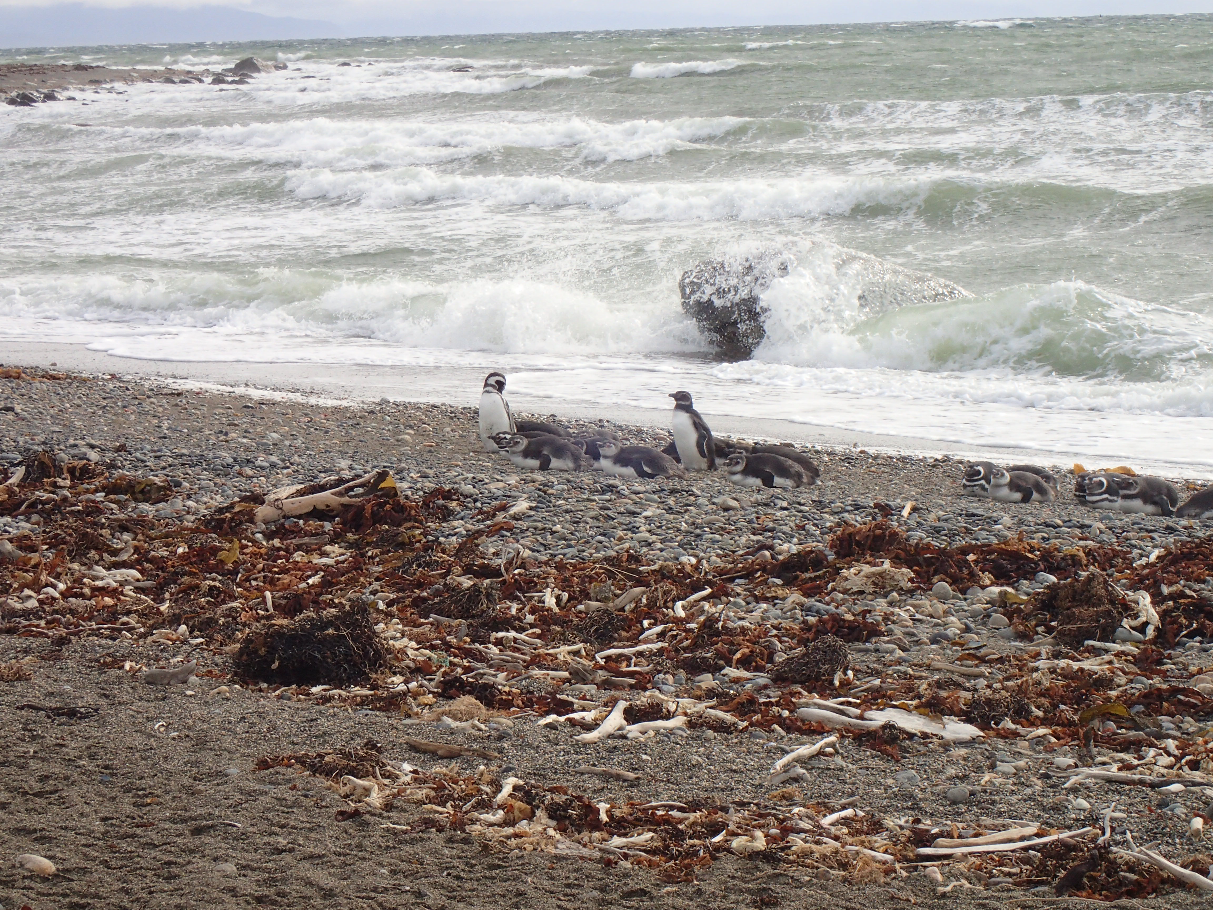
The owner of that land had turned it into a business, which also served to protect the small birds from unrestricted sightseers who used to come out here and drive on the beach, crushing their nests, and bringing their dogs, who mauled them.
“This is a business; it also helps to protect the birds. They are very capable in the water but vulnerable when they are on land, and this is where they have their babies,” Don Jorge explained.
They have made a great effort to make the area accessible for everyone, including handicap-accessible boardwalks and to disrupt the birds as little as possible. Where some years ago the colony would number up to 9,000, now only about 1,000 make the trek, “there is less food for them here,” they explain, as they have been keeping the numbers since opening the business.
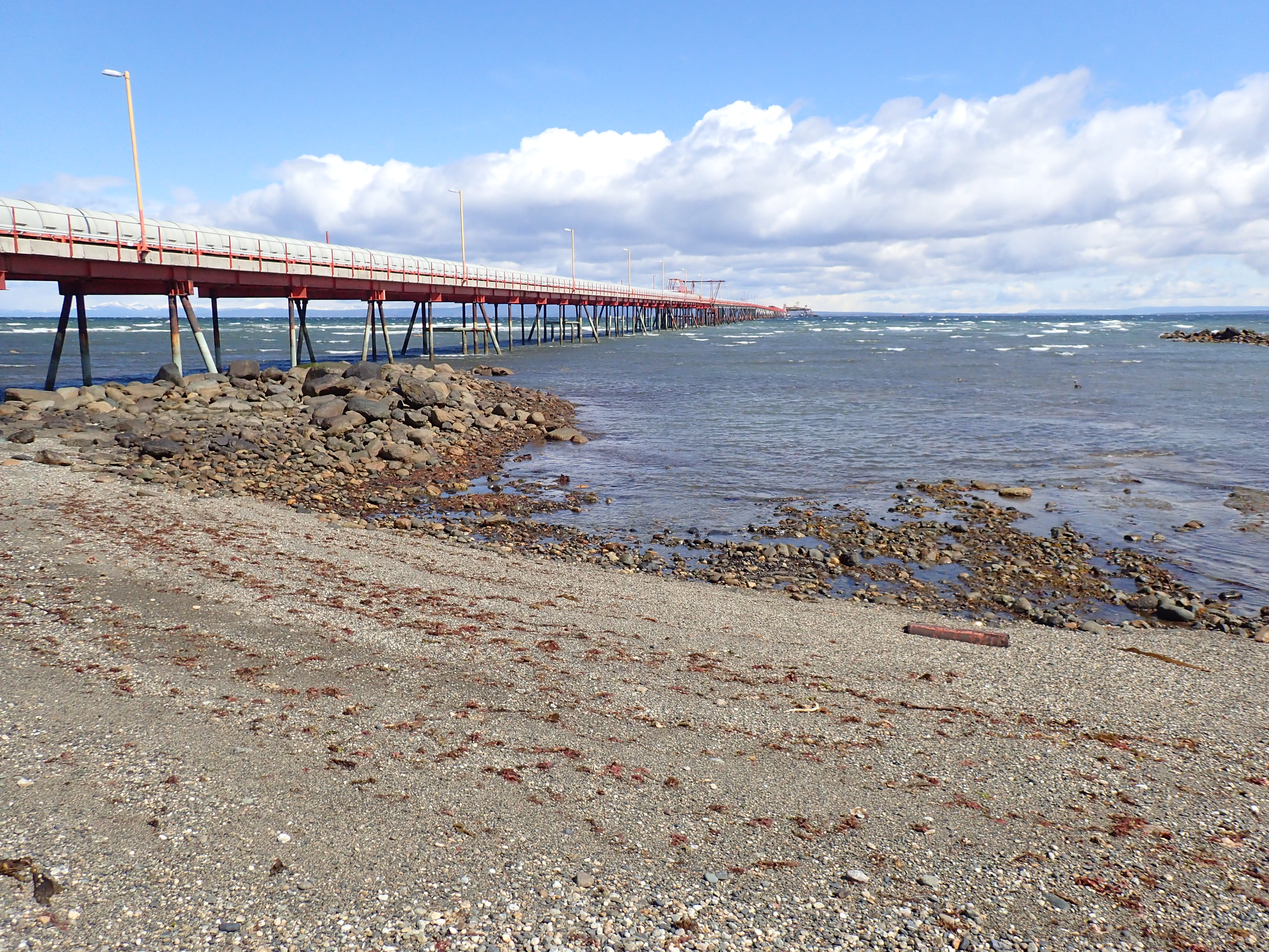
From there we traveled along the coast. Abandoned Mina Pecket made for an interesting landmark, reflecting the industrial history of the region. Where the abandoned road veered away from the coast, we took to the beach where the tide had receded, leaving us a wide swath of firm sand. We covered ground quickly until the tide chased us back in to the tidal pools and along the coast.
Soon we were again networking farm roads which led us up to Y 50, a lovely drive for those in vehicles. Hills provided a temporary relief from the wind but as we entered the narrows of Canal Fitz Roy, between the continent and Isla Riesco, the wind again pounded, the water, pulled in many directions by the tides churned and roiled.
We stopped at Estancia Rio Verde, staying with 2 kind cowboys who are fascinated by the idea of America. “Do people up there wear wool? Are you offended if we call you gringo? What is the government like? Have you ever tried cow tail soup before?”
Now I have.
Charlas de camino: Región del Magallanes
Traducción por Henry Tovar

Desde Punta Arenas, viajamos a lo largo de rutas de 4×4 olvidadas y un algúnos caminos de campo faciles. Navegando fuera de la ciudad, viajamos hacia el oeste. nos sentamos en el basurero de la ciudad en las afueras y se reflexionamos en las opciones de vida que nos habían traído hasta este punto, considerándolos en general impresionante, continuamos al oeste usando una combinación de imagenes de Google Earth, beta de Bruce, creador de SIG Patagon y dependiendo en gran medida de sus mapas.
 Chubascos de nieve empezaron a atraparnos. Nos encontramos a algúnos kilómetros de nuestra ruta prevista, pero continuamos al oeste de esperar. A medida que el mal tiempo había empezado a deteriorar la resolución de las imagenes de Google, buscamos algún tipo de ruta a través del espeso bosque que nos separa del oeste. nos encontramos fuera en las partes superiores abiertas de los cerros abiertos como el peor de los chubascos laminados. Nosotros retrocedimos, haciendo por alrededor del medio día ´´experiencia de aprendizaje´´. Hemos encontrado la ruta que habiamos buscado y tratamos de recuperar el tiempo perdido por sederismo en la noche como el sol se mantiene hasta las 10 pm aquí.
Salimos en un espacio plano alto, clara hace unos años. Aquí otro chubasco nos cogió al igual que la vejiga Platypus en mi mochila una vía de agua y vierten agua por toda mi espalda. Encontramos una arboleda misericordioso de árboles, armar la carpa y pasamos una noche fría y húmeda escuchar aguanieve y la caída de lluvia y heladas a nuestra tienda.
A la mañana siguiente había nieve en el suelo a medidas que empezamos de nuevo hacia el oeste por caminos agrícolas abandonadas. Las reglas generales de la pista son los mismos aquí abajo, deje una puerta como lo encontró y no tienen un incendio si hay peligro de que se extienda. Con la constante, el viento rasga, los fuegos abiertos estaban fuera de la cuestión en el espacio abierto a través del cual estábamos de paso.
Los chubascos continuaron. Me sentía como si estuviera en Colorado, saliendo de un barranco arbolado y ver una ráfaga de nieve contra el cielo azul por encima de nosotros. Finalmente salimos a la estancia de Marcos y Diana.
A partir de ahí, que la línea de la vista navegando hacia la costa, a Seno Otway. En dos días habíamos ido de excursión desde el Atlántico hasta el Pacífico. Esa tarde caminamos en una colonia de pingüinos.

El propietario de la tierra lo había convertido en un negocio, que también sirve para proteger a los pequeños pájaros de turistas de libre disposición que solían venir aquí y a conducir en la playa, aplastando a sus nidos, y llevar a sus perros, que los mutilados.
´´ Este es un negocio; sino que también ayuda a proteger a las aves. Ellos son muy capaces en el agua pero vulnerables cuando están en la tierra, y esto es donde tienen a sus bebes´´. Explicó Don Jorge.
Ellos han hecho un gran esfuerzo para hacer que el área accesible para todo el mundo, incluyendo pasarelas accesibles para discapacitados y para perturbar a las aves lo menos posible. Donde hace algunos años la colonia podría constar de hasta 9.000, ahora sólo alrededor de 1.000 hacer la caminata, ´´hay menos alimento para ellos aqui´´, explican, ya que han mantenido los números desde la apertura de la empresa´´.

A partir de ahí viajamos a lo largo de la costa. La mina abandonada Pecket hecha para ser un punto de referencia interesante, lo que refleja la historia industrial de la región. Cuando el camino abandonado desvió de la costa, nos llevó a la playa, donde se había retirado la marea, que nos deja una amplia franja de arena firme. Cubrimos terreno con rapidez hasta que la marea nos persiguió de nuevo a las pozas de marea ya a lo largo de la costa.
Pronto nos econtramos de nuevo la creación de redes de caminos agrícolas que nos condujeron a Y 50, un trayecto precioso para aquellos en los vehículos. Las colinas proporcionaron un alivio temporal del viento, pero cuando entramos en la angostura del canal Fitz Roy, entre el continente y la Isla Riesco, el viento de nuevo machacaba, el agua, tirandola en muchas direcciones por las mareas y batiendose enturbiada
Paramos en la Estancia Rio Verde, en casa de 2 vaqueros amables que están fascinados por la idea de Estados Unidos- ´´¿la gente allí llevan la lana? ¿está ofendido si te llamamos grigo? ¿como es el gobierno?¿alguna vez has probado la sopa de cola de vaca?´´.
Ahora lo hice.


Comments (7)
Thank you SO much for the update! I am following you girls all the way! I really enjoy the stories and wish you a safe journey!
Thank you!
My vote for favorite line: That afternoon we walked into a penguin colony. Incredible!
I was hoping you would see some penguins down there!! I hope the cow tail soup was spicy. Trek on ladies!!
wow. just wow! you are making my blog posts from culebra seem trite. wonderful write up – glad to hear of the survival stories. your command of writing is impeccable. i love you.
Dear Bethany, Thanks for the interesting and informative journal of your recent travel. We are learning much from your insights about people and places.
Be safe and dry and warm,
Cliff and Martha Rawley
Love reading all your posts! I am envious of your adventures! Thank you for sharing with all of us! Stay safe! Debbie Spinelli
Love the updates and stories along your route! Can’t believe you can go from snow showers to the beach (even penguins!) in the matter of a couple days. Keep it up!