Haz clic aquÍ para leer en español
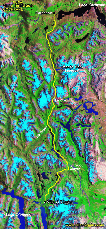
Cairns led us from the road up into the hills along the pitching rocks which frame lagos Christie and Alegre. There rolls a winding path where original settlers once passed. Lives on their horses and herds of livestock ambling along and around the hills, they made their way south to forge a life in frontier Patagonia.
This is hardly a trail. There are use trails; animal tracks crossing hither and yon and following the wrong one can result in down climbing or necessitate backtracking.
We knew we were on the right track when we passed sawed log ends or small bridges across bogs. Remains from a government backed effort to reclaim the trail about a decade ago. “Then the new alcalde was elected and he doesn’t care about anyone who doesn’t live in town,” growled one of the campesinos.
There are a few routes recorded on Wikiloc. Our greatest source of information was meeting Hans Silva in Villa O’Higgins. The website he keeps and is currently working to update is Villa O’Higgins Expediciones.
In the narrow corridors of clefts and standing boulders, rocks were scarred by horseshoes – I wondered whether from last year or 100 years ago. Faint markers led us through the grassy spaces, we waded through the lake along the bottom of a cliff. It was slow going but the weather was lovely and there were grand views across calm waters.
As Neon put it, it felt like we had stepped into a fairy-tale. The instructions from the pobladores were toward the end of the first lake, you will find the first gaucho. He will give directions to the second gaucho who will show you the correct pass and valley to Cochrane.
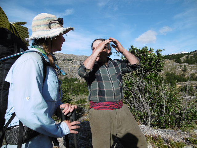
After a few days of bog hopping and trail choosing, we came upon Ruen Pradena as he was eating breakfast. We could smell the frying bread and felt bad at the idea of interrupting. Before we even got to his house he abandoned the meal and ushered for us to follow him. He spoke in the clipped accent of the Chilean campesino, and I struggled to understand.
We He chatted while we walked, sharing his story. He told about his father and his sons. He was proud of the land he owned and had watched how it changed. He, as with several others we have met, did not seem able to read. He watched curiously as I scribbled notes in my pocket book.
As I began to wonder whether he intended to hike the rest of the day with us we emerged on an open rise where he indicated our path forward. He was patient and even asked if we had a map, something few know how to use out here.
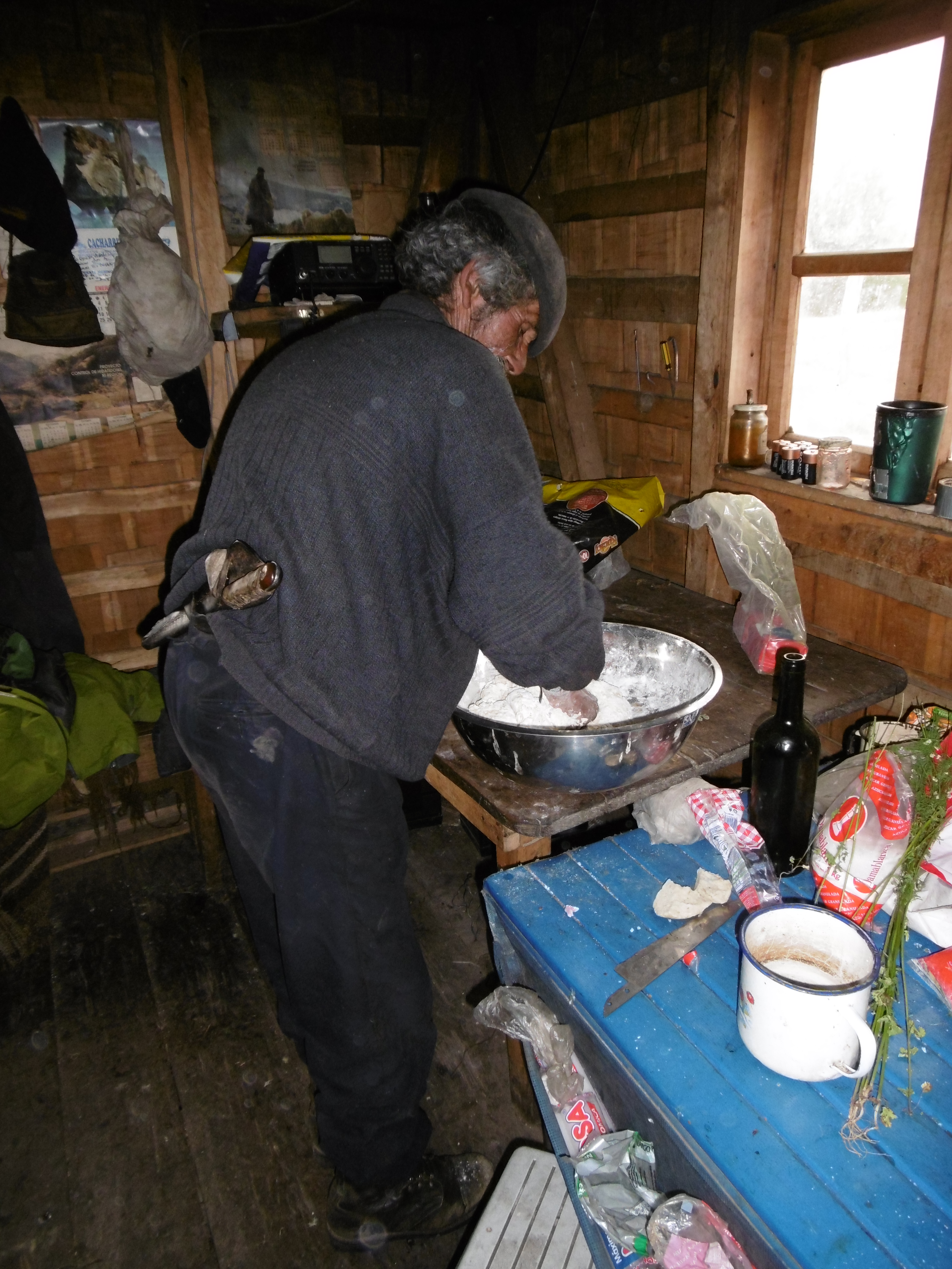 Again we climbed, passing refugios, some old, some new. The next day, we happened into the grounds of Don Rial – a fascinating character. We passed the night, listening to his tales and then, in an amenable silence, listened to Santa Maria am station before going to bed.
The radio was stacked against the wall, the antenna bent and the lid of a pot set on top of it to hone in on the signal. AM radio is an integral piece to this way of life. To explain it, to tell the story of this man is so much more than can be put in a blog. He is one I will save for the book.
The next morning we headed back into the woods. “No hay donde perderse,” the old gaucho insisted. Immediately we took a wrong turn and were walking in a large circle under the huge old trees when Neon pointed out, “there is a man on a horse over there.” Don Rial rode up, led us back to the turn we had missed, and off we went, following up along Rio Bravo. At its headwaters, donde el rio nasce from a tarn, we crossed and began ascending toward the pass.
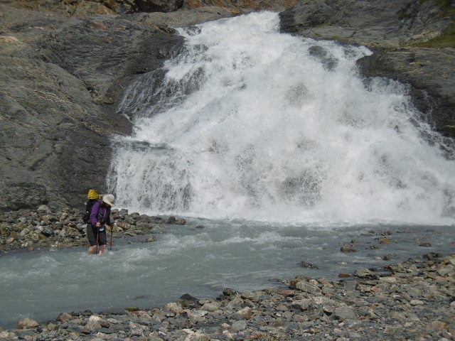 We climbed and clambered between rocks and roaring waterfalls which connected the hanging glaciers above to the tarn below. This climbing was above tree line, where not even grasses and barely any mosses grow, where the only other living creature we saw was a “fat little walking bird.” It looked like a moonscape up here. Finally, though, we made it to the pass.

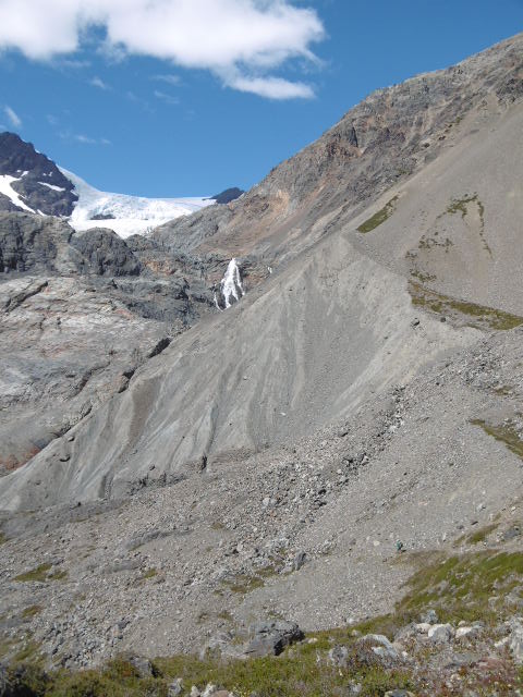
From there, we looked back. We looked ahead to blocky, precipitous Mount San Lorenzo. It is a heady feeling to stand so high, to survey the land, looking into both Argentina and Chile, at peaks cupping glaciers.
Descending to the campsite, we missed a tricky turn, making it necessary to climb back up, retrace, then move ahead, teetering on an abandoned path along a canyon wall.
We headed into another glacier valley, crossing 6 threads of freezing water, and pounding quickly along the trail once across trying to keep blood flowing to our frozen limbs in the evening cool.
Over the final days the path became clearer, more consistent. Through campo, through mud, through rivers and brush we pushed forward, at times losing it in meadows, and finding it at the edge of woods.
As has become the routine of the trek, the slight path became trail and trail became double track. Double track gave way to heavy machinery and gravel road. The gravel road led us to the Carretera Austral, route 7 (which was also still gravel), for the 4 km along into Cochrane.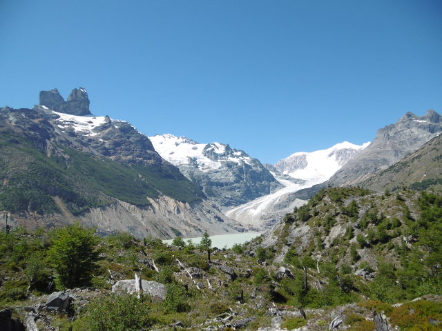
Rutas de los pioneros.
Traducción por Henry Tovar
 Cairn nos llevó desde la carretera hacia las colinas a lo largo de las rocas puntiagudas que marcan el lago Christie y Alegre. Hay marcas de un camino sinuoso donde los colonos originales alguna vez pasaron. Vive sobre vivían sobre sus caballos con manadas de animales de granja deambulando a lo largo y alrededor de las colinas, hicieron su camino hacia el sur para forjar una vida en la frontera de la Patagonia.
Esto apenas es un camino, hay senderos usados, huellas de animales que cruzan de aquí para allá y seguir el camino incorrecto puede resultar en tener que escalar hacía abajo o necesariamente dar marcha atrás.
Supimos que estábamos en el camino correcto cuando pasábamos extremos de un tronco aserrado o pequeños puentes a través de los pantanos. Restos de un esfuerzo respaldado por el gobierno para recuperar el camino hace una década. “Luego el nuevo alcalde fue elegido y él no se preocupa por nadie que no viva en la ciudad” gruñó uno de los campesinos.
Hay algunas rutas grabadas en Wikiloc. Nuestra mayor fuente de información fue reunirnos con Hans Silva en Villa O´HIggins. El sitio web que el maneja funciona actualmente y está trabajando para actualizar sus expediciones en Villa O´Higgins.
En los estrechos pasillos de hendiduras y cantos rodados de pie, las rocas fueron marcadas por las herraduras de caballos, me preguntó si desde el año pasado o desde hace 100 año. Débiles marcas nos condujeron a través de los espacios cubiertos de hierba, vadeamos a través del lago a lo largo de la parte inferior de un acantilado. Era algo lento, pero el tiempo era precioso y había grandes vistas a través de las aguas tranquilas.
Como Neon lo puso, se sentía como si hubiéramos entrado en un cuento de hada. Las instrucciones de los pobladores eran hacia el final del primer lago, encontraras el primer Gaucho. Él les dará instrucciones para el segundo Gaucho que les mostrará la contraseña correcta y el valle de Cochrane.
 Despues de unos días de salto de pantano y la elección de camino, nos encontramos con Ruen Pradena mientras él estaba comiendo el desayuno. Podíamos oler el pan freír y nos sentimos mal con la idea de interrumpir. Antes de que incluso llegaramos a su casa, abandonó la comida y marcó el comienzo para nosotras seguirlo.
Nos habló con el acento recortado del campesino Chileno, luché para entender.
Hablabamos mientras caminabamos, compartiendo su historia. Él nos habló de su padre y sus hijos. Estaba orgullos de la tierra que tenía y había visto cómo había cambiado. Él, al igual que con muchos otros que hemos conocido, no parecía capaz de leer. La observaba con curiosidad mientras garabateé notas en mi libro de bolsillo.
A medida que empecé a preguntarme si tenia intención de recorrer el resto del día con nosotros surgimos en un lugar abierto donde nos indicó nuestro camino hacia adelante. Él fue muy paciente en incluso preguntó si teníamos un mapa, algo que pocos saben como utilizar aquí.
 De nuevo subimos, pasando refugios, algunos antiguos y otros nuevos. Al día siguiente, nos llegamos a los terrenos Don Rial, un personaje fascinante. Pasamos la noche, escuchando sus cuentos, y a continuación, en un silencio suceptible, escuchamos a la estación de Santa María de la mañana antes de ir a la cama.
La radio estaba apilada contra la pared, la antena doblada y la tapa de una olla fijada en la parte superior de la misma para afinar la señal. La radio AM es una pieza integral de esta forma de vida.
Para explicarlo, para contar la historia de este hombre es mucho más de lo que se puede poner en un blog. Es una que voy a guardar para el libro.
A la mañana siguiente nos dirigimos de nuevo hacía el bosque. ´´no hay donde perderse,´´ insistió el viejo gaucho. Inmediatamente dimos un giro equivocado y estábamos caminando en un círculo grande bajo los enormes árboles viejos cuando neno señaló, ´´hay un hombre a caballo por allí´´. Don Rial montó arriba, nos llevó de nuevo a la vez que nos habíamos perdido, y nos fuimos, el seguimiento a lo largo del Río Bravo. En su cabecera, donde el río nace de un tarn, cruzamos y empezamos a ascender hacia el paso.
 Nos subimos y trepamos entre las rocas y cascadas rugientes que conectaban los glaciares que cuelgan por encima de la laguna a continuación. Esta escalada estaba por encima de la linea de los árboles, donde crecen ni siquiera los pastos y apenas ninguna musgos, donde la única otra criatura viviente que vimos fue un ´´pajarito pie de grasa´´. Parecia un paisaje lunar hasta aquí. Finalmente, sin embargo, que lo hizo a la pasada.

 A partir de ahí, miramos hacía atrás. Miramos adelante a bloque, precipitada Monte San Lorenzo. Es una sensación embriagadora de pie tan alto, para inspeccionar la tierra, mirando en la Argentina y Chile, en los picos puntiagudos de los glaciares.
Descendiendo al camping, nos perdimos un giro complicado, por lo que fue necesario volver a subir, y luego seguir adelante, balancéandonos en un camino abandonado a lo largo de una pared de cañón.
Nos dirigimos a otro valle glaciar, cruzamos 6 hilos de congelación del agua, y golpeando con rapidez a lo largo del sendero por otro lado tratando de mantener el flujo sanguíneo a nuestras extremidades congeladas en el fresco de la noche.
Durante los últimos días el camino se hizo más clara, más consistente. A través de campo, lodo, ríos y acantilados seguimos adelante, a veces perdernos en prados, y encontrarnos en el borde del bosque.
Como se ha convertido en la rutina de la caminata, el ligero camino se hizo sendero, y el sendero se convirtió en doble vía, doble vía dio paso la maquinaria pesada y camino de ripio. Este ultimo nos llevó a la carretera Austral, la ruta 7 (que también era todavía de grava), para los 4km a lo largo de cochrane.



Comments (2)
I just keep thinking, “Wow.” I’m continuously astounded, awed, envious, encouraged, inspired, and aspired by this journey you and neon have taken on.; courage, brevity, openness, acceptance, and patience., upon many more I’m sure. I look forward to hearing tales told face to face. And I have to say: the writings you and neon have been producing have helped me be in the experience without ever being there. Although it would be quite nice to be in the flesh:). This last writing reminded me of the time, fidget, on the PCT when u lost ur backpack in the sierras. Those craggy crotchedy cliffs wrestled you for that precious item. It just produced a smile thinking of all your might! Love y’all.
Thank you for allowing everyone to follow your steps through your eloquent words and awe inspiring photos. Safe journeys!