Haz clic aquÍ para leer en español
The ferry across Lago General Carrera from Chile Chico was booked, so we ended up spending an extra day there. The tourist information girl didn’t even know where public bathrooms were in town. The women at the government office were much more helpful. They shared with us what maps they had and demonstrated an impressive knowledge of the area to the north.
The next morning we took a ferry across Lago General Carrera, the lake which claimed Doug Tompkin’s life. In Puerto Ibáñez we restocked Neon’s food supply, as a sneaky camp dog had stolen all her lunches the night before.
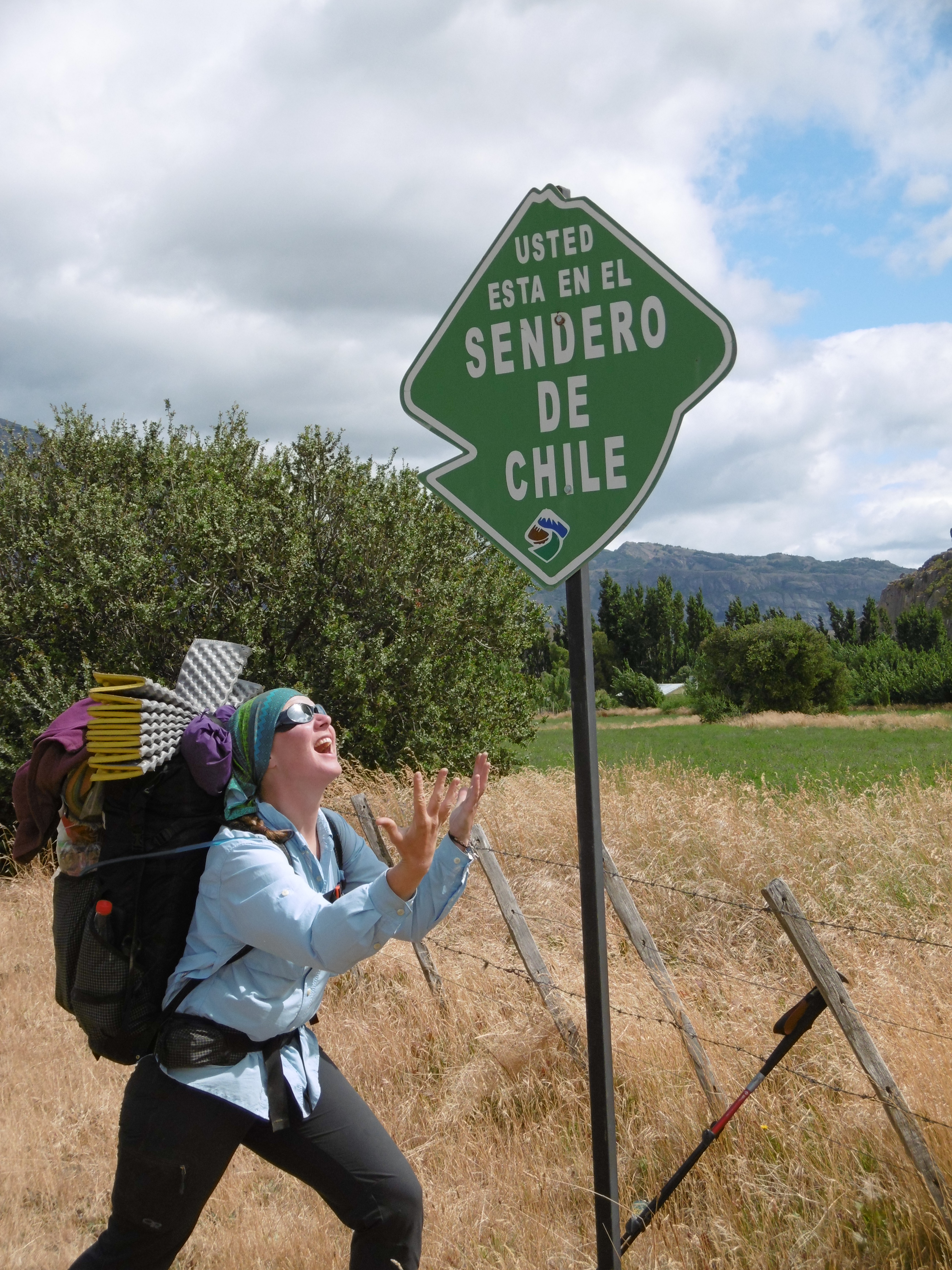 Here we began walking on the exploratory section of the Greater Patagonian Trail. Jan had heard rumor of some work done on the “Sendero de Chile” through this area, so we were to keep our eyes peeled. Markers were along the roadside for the first 25 or so kilometers. Just as we began to scoff, to regard the Sendero de Chile as a fable altogether, we came over a rise and saw a stile over a fence and one of the markers veered away from the road just before Lago Central. Could it be true?
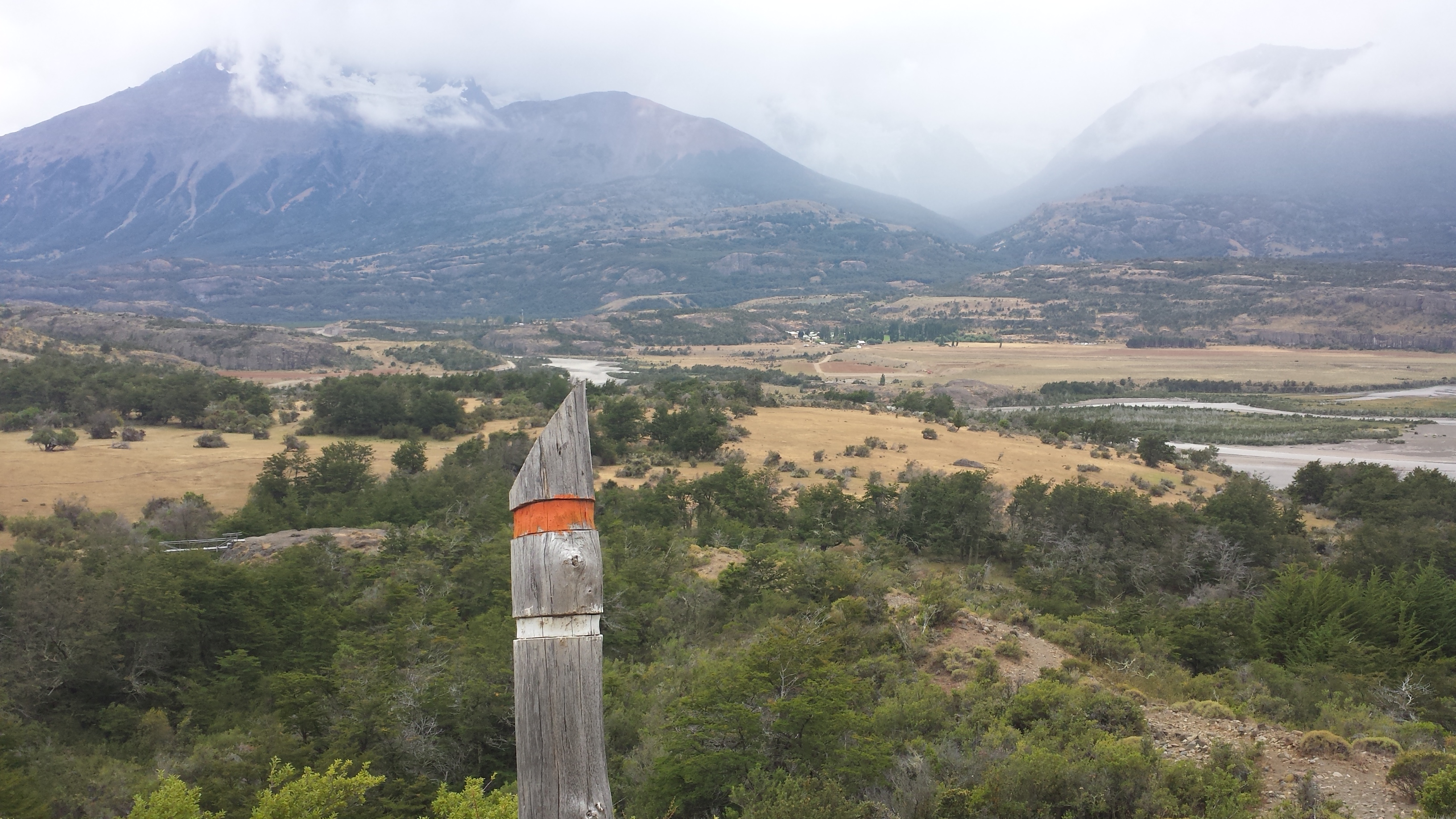 It was! The sendero followed a two track past a beautiful fishing lodge. From there it became legitimate trail. Well marked by the tall posts, we were thrilled and rolled quickly in to the village of Cerro Castillo. Here there seemed to be more hitchhikers than residents. We ate lunch, chatted with a couple from Oregon and then headed for the park as the clouds which had loitered all day began to mount.
Just as we began the steep climb up the mountains, a cavalcade came down amidst a cloud of dust. The guide stopped the whole procession to warn us of bad weather up top. We promised to discuss our options. Soon after them, two women came down; they both looked well-equipped, and we asked how it was. They explained they had intended us to stay up there, but the squalls and wind were rough.
“Maybe if you are professional mountain hikers or something you will be better than us, but we came down,” one admonished. We thanked them for the information and continued discussing. They seemed to wait to hear our decision but hiked on.
 One of the greatest, constant dangers one faces out here is her own ego. Reactively, my pride had jumped at the perceived challenge in her voice when she had warned us not to go up.
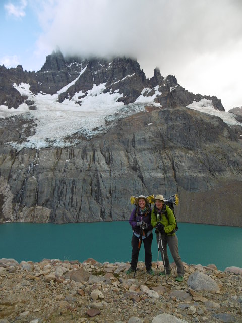
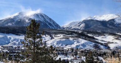
Recognizing this we talked ourselves out of pushing up and instead made camp at the base. The next morning we climbed for several hours to a sub-glacial lake amidst a large rockfield.
Again we enjoyed having clear trail and traversed the popular route in a day. Emerging at the CONAF station on the other side, we were met by the guardparque, Juan. He was very kind and related his experience of herding cattle in Wyoming for 3 years. We asked about the alternate route out of the park, following north rather than east.
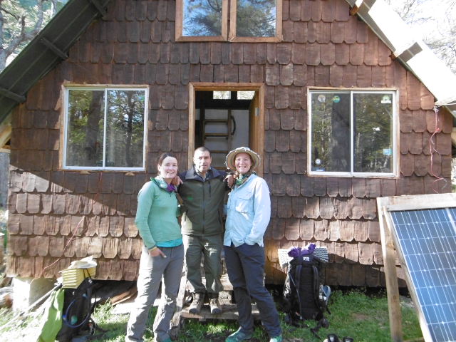 He was hesitant, “very few people go that way, there have been too many avalanches,” he insisted. Over the course of the evening we persisted gently over conversation and mate. By the next morning he determined the weather was good enough and shared what information he knew about the abandoned route. We also found it in a guidebook from 2003 which he kept carefully in his cabin.
At first there was a logging road, then a bit of rock-field scramble, an abandoned trail to tree line. Large cairns marked the way over the pass. We began to feel confident. “What kind of dummy can’t follow cairns this big,” we joked.
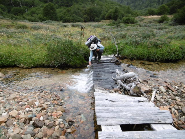
Within the hour, we had completely lost the trail and spent the rest of the evening fighting through trees, sliding across a wide, sandy avalanche washout, and clambering through a steep creek bed several hundred meters deep. We camped in wilderness.
The next morning, we found the trail 10 minutes uphill. Again, there is no room for cockiness out here. Each time we cop an attitude, mother nature is right there to smack it back down. This is why I love her so. This is something I know I can trust.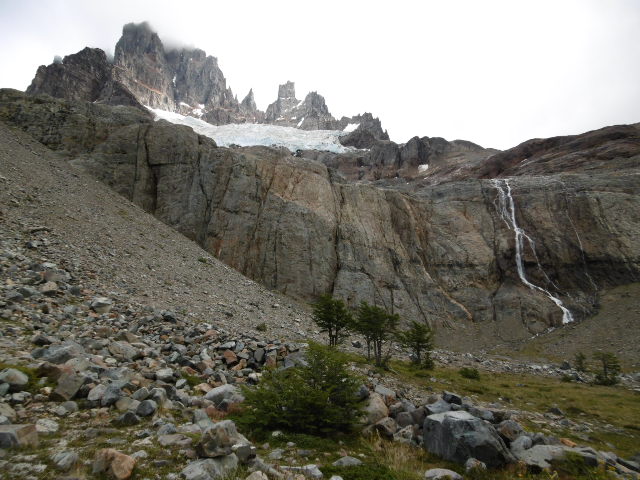
Rutas y lo contrario a través de Cerro Castillo
Traducción por Henry Tovar
El ferri a través del Lago General Carrera desde Chile Chico estaba lleno, así que terminamos de pasar un día extra allí. La chica de turismo ni siquiera sabía dónde estaban los baños públicos en la ciudad. Las mujeres de la oficina del gobierno eran mucho más útiles. Compartieron con nosotras los mapas que tenían y demostraron un impresionante conocimiento de la zona al norte.
A la mañana siguiente tomamos un ferri a través del Lago General Carrera, el lago que se cobró la vida de Doug Tompkins. En Puerto Ibáñez repusimos el suministro de alimento de Neon, ya que un perro de campo astuto había robado toda su comida la noche anterior.
 Aquí comenzamos a caminar en la sección de exploración del más grandioso sendero Patagónico. Jan había oído el rumor de algún trabajo realizado en el “Sendero De Chile”, a través de esta área, por lo que íbamos a mantener los ojos bien abiertos. Los marcadores fueron a lo largo del borde de la carretera durante los primeros 25 kilómetros o menos. A penas empezamos a bromear, a considerar el Sendero de Chile como una fabula por completo, nos encontramos en un lugar y vimos un montante de más de una valla y uno de los marcadores se desvió de la carretera justo antes del lago central. ¿Podría ser verdad?
¡Lo era! El sendero seguido de dos pistas más allá de un hermoso refugio de pesca. A partir de allí se convirtió en sendero legítimo. Bien marcado por los postes altos, nos quedamos encantadas y rodamos rápidamente en la localidad de Cerro Castillo. Aquí nos parecía haber más autoestopistas que residentes. Tomamos el almuerzo, charlamos con un par de Oregón y luego nos dirigimos para el parque al tiempo que las nubes que habían estado quietas todo el día empezaban a montar. 
A medida que comenzamos la subida empinada hasta las montañas, un desfile descendió en medio de una nube de polvo. La guía se detuvo toda la procesión para advertirnos del mal tiempo hasta la parte superior.
Prometimos discutir nuestras opciones. Poco después de ellos, dos mujeres bajaron; ambos miraron bien equipados, y nos preguntaron cómo era. Explicaron que no habían tenido la intensión de permanecer allí, pero las ráfagas de viento eran ásperas.
“tal vez si usted es excursionista de montaña profesional o algo que va a ser mejor que nosotras pero nosotras llegamos abajo”. Una amonesto. Le agradecimos por la información y continuamos discutiendo. Parecían esperar a escuchar nuestra decisión, sino que caminamos sobre.
 Uno de los mayores, peligros constantes que uno enfrenta aquí afuera es su propio ego. Reactivamente, mi orgullo había saltado en el desafío percibido en su voz cuando nos había advertido que no subiera.
Reconociendo esto hablamos nosotras mismas para seguir adelante en vez de hacer un campamento en la base. A la mañana siguiente subimos por varias horas a un lago sub- glacial en medio de un gran patio de rocas.
Una vez más nos gusto tener un sendero claro y atravesar la popular ruta en un día. Emergente en la estación de CONAF en el otro lado, nos encontramos con el guarda parque, Juan. Fue muy amable y relato su experiencia de pastoreo de ganado en Wyoming durante 3 años. Nos preguntamos por la ruta alternativa fuera del parque, siguiendo el norte en lugar de este.
 El tenia dudas, “muy poca gente va de esa manera, ha habido demasiadas avalanchas”, ha insistido. En el transcurso de la noche persistíamos suavemente sobre la conversación y se aparean. Por la mañana siguiente se determina el tiempo era lo suficientemente bueno y se comparte la información que el sabia sobre la ruta abandonada. Así mismo, se encontró que en una guía a partir de 2003 que guardaba cuidadosamente en su camarote.
Al principio había un camino forestal, a continuación, un poco de revuelo campo roca, una pista abandonada de la línea de arboles. Grandes tumultos marcaron el camino sobre el pase. Empezamos a sentir confianza. “que tipo de maniquí no puede seguir así de grandes montones de piedra, “. Bromeamos.

En más o menos una hora ya habíamos perdido completamente la pista y pasamos el resto de los combates por la noche a través de los arboles, deslizándonos por un amplia, y lavada avalancha de arena, y trepando a través de una empinada lecho del arroyo varios cientos de metros de profundidad. Acampamos en el desierto.
A la mañana siguiente, encontramos la pista de 10 minutos cuesta arriba, una vez más, no hay lugar para la chulería aquí. Cada vez que manejamos una actitud, la madre naturaleza esta allí para golpearnos hacia abajo. Esa es la razón por la que la amo. Es algo en que sé que puedo confiar.



Comments (3)
God bless you ladies. Y’all are in my prayers. Very interesting blogs. How many miles a day do you average. Do you have tents or hammocks ? If you have time to respone. God bless.
Depending on the terrain and navigation demands we usually cover between 15-25 km per day.
We have a Hyperlite Mountain Gear tent which sets up using our trekking poles!
Pingback: The Tompkins Land Donation: Shedding Light on Chile’s Conservation Conundrum – Her Odyssey