Written by Neon
Haz clic aquí para leer en español

We were caught in town for a day of rain and made our way out of Puerto Fuy as the leafy trees were still dripping. We walked along Lago Pirihueico and worked our way up a steep trail that looked like an overgrown road. There were Sendero de Chile Markers along the trail the entire first day, so we were pleasantly surprised to be following a marked trail. Though it had stopped raining, the humidity was still oppressive. As the trail went up, so did the amount of sweat accumulating on my skin and soaking through my shirt. We went up and down, and up and down, along the valleys we followed for two days before dropping elevation into the deep valley that held multiple small towns.


Having planned for 3 days of food, we just had to resupply with snacks in the small shops of Luiquine. We then walked 5 km along the main road through the valley before turning off and finding camp. Hot road walking had really sapped my energy that day, and I fell into a exhausted sleep in the tent after dinner. I woke up the next morning rested, only to find a critter had snacked on my breakfast bag during the night. Somewhat frustrated, I relocated my breakfast into a new bag and packed up. We walked down the road northward, unsure of how long the road walk would be that day. Thankfully it wasn’t long before the dirt road turned into 2 track which then crossed a stream and became more and more of a footpath. We were appreciative of the shade as we climbed up and up that day- from about 200 meters in elevation to where we made camp at about 1500 meters. As we moved up, thick forest thinned and we saw less underbrush. The birds were ever present, though it seemed as though different species had different areas they occupied. We hit treeline near the end of our day, came up over a pass to Lago Los Patos and set up camp. We then promptly got into the water. It was so lovely to rinse the salt off my face after such a sweaty day. I can tell I’ve been living in the desert most recently.


After our high mountain lake rinse, we assessed our timing. We had entered Parque Nacional Villarica and discovered it would only be another day and a half of walking until we got into Curarrehue. To give context, we had planned on 6 days to get there, and we were currently a day and a half into those 6 days.We had also let some friends in Pucon know what our timeline was looking like. We were able to send those friends a message with our DeLorme Tracker so we didn’t surprise them by being over a week early! And of course, we were now carrying way more food than we needed. Walking (as well as life) always has lessons for you, and you may learn something if you’re willing to see them.

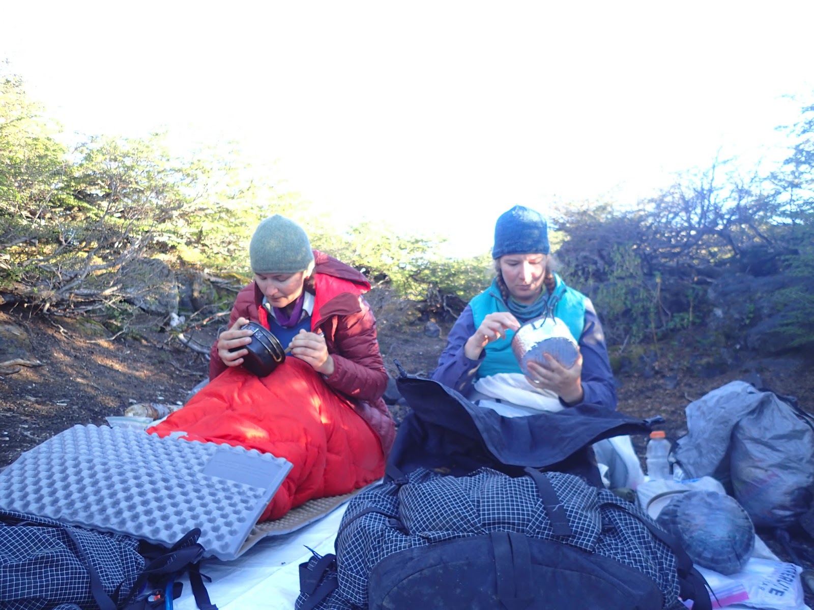

So, we camped out at Laguna los Patos, and the next day the route took us into a couple of older lava flows. They were cool to walk through, with ‘young’ rock poking out all around us. We then traversed a pass and down along Lago Blanco, a whitish colored lake with many different streams flowing into it. After crossing such an exposed area, it was nice to get back down to treeline and have some shade from the glaring sun. We spent the afternoon going down and down a trail/old road from treeline to a locked gate. From what we understood, the northern side of the trail/old road we were following was privately owned, and the gate was there to keep out dirt bikers who would come onto the land and leave a mess of trash.


We came back into actual drive-able road near the end of the day and were able to find a tucked away spot near a stream to camp for the night. The next morning, we packed up and went up and down and up and down for about 15 kilometers to get into Curarrehue. We got some snacks and supplies then found internet connection to contact our friends Greta and Ale (pronounced Ah-ley) and get directions to their property. After a couple hours, we then found our way by bus, hitch-hiking, and walking to them. It was so nice to lay my head down in the house of friends that night, as navigating town is harder than navigating trail for me.

We woke up the next morning to REAL coffee (most down here is instant) and good conversation while bacon and eggs cooked on the stove. Ale’s cousins had arrived in the night, so it was a full house, and we were able to all get together and enjoy each other’s company. Spanglish became the main conversation language, and we were all enjoying the many stories that were swapped throughout the next couple of days.

Click here to go Neon’s blog page.
Puerto Fuy a Curarrehue y pasando tiempo cerca de Pucón
Escrito por Neon
Traduccion por Henry Tovar

Nos quedamos atrapadas en la ciudad en un día lluvioso y nos abrimos camino a Puerto Fuy al tiempo que los árboles frondosos todavía estaban goteando. Caminamos por el Lago Pirihueico y subimos por un sendero empinado que parecía un camino cubierto de vegetación. Había marcadores de Sendero de Chile a lo largo del sendero todo el primer día, así que nos sorprendió gratamente seguir un sendero marcado. Aunque había dejado de llover, la humedad seguía siendo opresiva. A medida que el sendero ascendía, también aumentaba la cantidad de sudor que se acumulaba en mi piel y que absorbía la camisa. Subíamos y bajábamos y subíamos y bajábamos por los valles que seguíamos dos días antes de desprender la elevación hacia el profundo valle que tenía varios pueblos pequeños.


Habiendo planeado para 3 días de comida, sólo tuvimos que reabastecernos con aperitivos en las pequeñas tiendas de Luiquine. Luego caminamos 5 km a lo largo de la carretera principal a través del valle antes de pararnos y encontrar un campamento. Caminar con tanto calor había realmente minado mi energía ese día, caí agotada en un sueño en la tienda después de la cena. Me desperté a la mañana siguiente descansada, sólo para encontrar un bicho se había metido y comido mi bolsa de desayuno durante la noche. Algo frustrada, volví a poner mi desayuno en una bolsa nueva y empecé. andamos por el camino hacia el norte, inseguras de cuánto tiempo tomaría la caminata ese día. Afortunadamente no pasó mucho tiempo antes de que el camino de tierra se convirtiera en 2 pistas, que luego cruzó un arroyo y se convirtió en más y más de un sendero. Apreciamos la sombra mientras subíamos ese día, desde unos 200 metros de altitud hasta donde acampamos a unos 1500 metros. A medida que ascendíamos, el espeso bosque se adelgazaba y vimos menos maleza. Las aves estaban siempre presentes, aunque parecía que diferentes especies tenían diferentes áreas que ocupaban. Llegamos al límite donde crecen los árboles cerca del final de nuestro día, subimos por un pase al Lago Los Patos y montamos el campamento. Entonces rápidamente nos metimos en el agua. Fue tan encantador poder enjuagar la sal de mi cara después de un día tan sudoroso. Puedo decir que he estado viviendo en el desierto más recientemente.


Después de nuestro enjuague en el lago de alta montaña, evaluamos nuestro tiempo. Habíamos entrado en el Parque Nacional Villarica y descubierto que sólo sería otro día y medio de caminata hasta que llegamos a Curarrehue. Para dar contexto, habíamos planeado en 6 días para llegar allí, y estábamos actualmente un día y medio en esos 6 días. También habíamos dejado saber a algunos amigos en Pucon lo que nuestra línea del tiempo era como. Hemos sido capaces de enviar a esos amigos un mensaje con nuestro DeLorme Tracker así que no nos sorprendió por ser más de una semana antes! Y por supuesto, ahora llevábamos más comida de la que necesitábamos. Caminar (así como la vida) siempre tiene lecciones para usted, y usted puede aprender algo si está dispuesto a verlos.


Así que, acampamos en Laguna los Patos, y al día siguiente la ruta nos llevó a un par de antiguos flujos de lava. Eran geniales para caminar a través de ellos, con “Rocas Jóvenes” que se asomaba a nuestro alrededor. Luego atravesamos un paso y bajamos por el Lago Blanco, un lago de color blanquecino con muchos arroyos diferentes fluyendo hacia él. Después de atravesar una zona tan expuesta, era agradable volver al límite donde crecen los árboles y tener algo de sombra del sol deslumbrante. Pasamos la tarde bajando y bajando un sendero / vieja carretera del límite a una puerta cerrada. Por lo que entendíamos, el lado norte del sendero / camino viejo que seguíamos era de propiedad privada, y la puerta estaba allí para mantener fuera de los moteros de la suciedad que venían a la tierra y dejar un lío de basura.


Volvimos a la carretera cerca del final del día y pudimos encontrar un lugar lejos escondido cerca de un arroyo para acampar por la noche. A la mañana siguiente, empacamos y subimos y bajamos y subimos y bajamos por unos 15 kilómetros para llegar a Curarrehue. Nos dieron algunos bocadillos y suministros y luego encontramos conexión a internet para contactar con nuestros amigos Greta y Ale (pronunciado Ah-ley) y obtener direcciones a su propiedad. Después de un par de horas, encontramos nuestro camino en autobús, autoestop, y caminando. Fue tan agradable para poner mi cabeza para dormir en la casa de amigos esa noche, como navegar la ciudad es más difícil que navegar los rastro para mí.

Nos despertamos la mañana siguiente a café REAL (la mayoría aquí es instantánea) y buena conversación mientras tocino y huevos cocinados en la estufa. Los primos de Ale habían llegado por la noche, así que era una casa llena, y pudimos reunirnos y disfrutar de la compañía de los demás. Spanglish se convirtió en el lenguaje de conversación principal, y todos estábamos disfrutando de las muchas historias que fueron intercambiados a lo largo de los próximos dos días.



Comments (3)
Hi,
I started following you as always wanted to do what you are doing. All the best Lots of love from Birmingham England
Mr Amjad Malik xx
Sent from my iPhone
Again, thanks for sharing your descriptive and interesting commentary on the adventure of your long walk. We admire your resourcefulness and courage!
Listed below are just a few of our favourite places.